Dipping Our Toe in Water Atlases

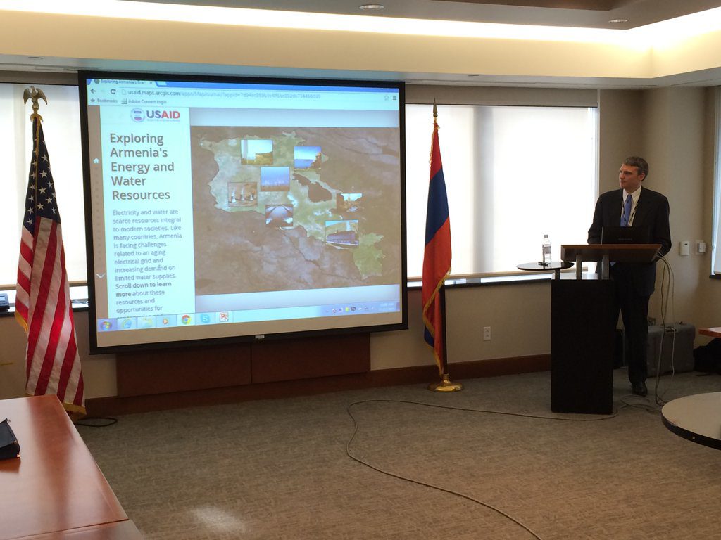
Armenia is a country where chess is a required subject in schools and apricots are a treasured piece of culture, but it’s also a nation with limited water supplies and an aging electrical grid. And since Armenia’s electricity comes from a variety of renewable and non-renewable resources, each possesses its own strengths and weaknesses. So, in an effort to make more effective and efficient development investments in a country that straddles both Europe and Asia, Brian B. worked with USAID on a Freedom Consulting Group program as team lead to develop the Armenian Water and Energy Web Atlas.
For more than 20 years USAID has invested its time and resources into this country’s water and energy sectors, and some terrific reports have been produced as a result of these programs. But here’s the problem: These reports, with troves of maps and geographic data, have, for the most part, been inaccessible to the public.
Here’s a few interesting points to walk away with:
- The country’s newest venture in renewable energy is the Lori 1 Wind Farm, a project that cost about $3.2 million.
- Armenia’s largest river, the Aras River, makes up part of the border with Turkey.
- Most areas that receive the least amount of precipitation are agricultural areas, like the Ararat Valley, leaving farming dependent upon irrigation.
- Annual precipitation varies, ranging from 200-1000 millimeters a year.
- Irrigation accounts for the single largest use of water in Armenia.
As a GIS specialist with the USAID Global Development Lab’s GeoCenter, Brian developed an application that would amalgamate this collection of geographic information from a variety of sources, mitigating the problem that had come to be. The web atlas was developed using Esri’s ArcGIS Online, Server and Story Map technology by the USAID Global Development Lab’s GeoCenter, and was then presented to Armenian stakeholders, including representatives from the Ministry of Nature Protection, Ministry of Agriculture, Ministry of Energy, donor groups and academia in November.
So, who can use the Water and Energy Water Atlas? Simply put, everyone. But some groups will particularly benefit: USAID, other donor programs, government ministries, NGOs and academic institutions. It’s a publically accessible tool that can, and will, help an array of audiences better understand Armenia’s energy and water challenges and opportunities.
Read more about what makes this tool unique, here. And then check out Brian’s achievement.
We’re proud to have employees who not only have the freedom and opportunity to be a part of incredibly important and extraordinary work, but also the desire to be. Well done Brian, well done.
